Friday, July 13, 2012

Day 33: Van to Sarp

Not quite so hidden from the rising sun as were we expecting, we awoke to a tent rapidly becoming a sauna and emerged into brilliant sunshine over the lake shore. The gentle sounds of the waves lapping the shoreline had been soothing to sleep to, and we were both feeling well rested. Seizing the day, I enjoyed another swim in the lake whilst Gerle prepared breakfast. With the air temperature warmer than the previous night, the water seemed colder, and after splashing about for a while  I was glad to get out and dry off on the hot rocks.

After a quick breakfast of bread, tomatoes and cucumbers we had the campsite packed up and were on the road. After meandering back through the countryside to the main highway, we stopped for fuel, where Gerle was made decidedly uncomfortable from some unwanted attention from the shopkeeper whilst I was busy fuelling the car. How is it that the Turkish men can be so charming and yet so creepy? Cutting short a fantasy or two, we were headed in the direction of Narman as soon as the fuel bill was paid.

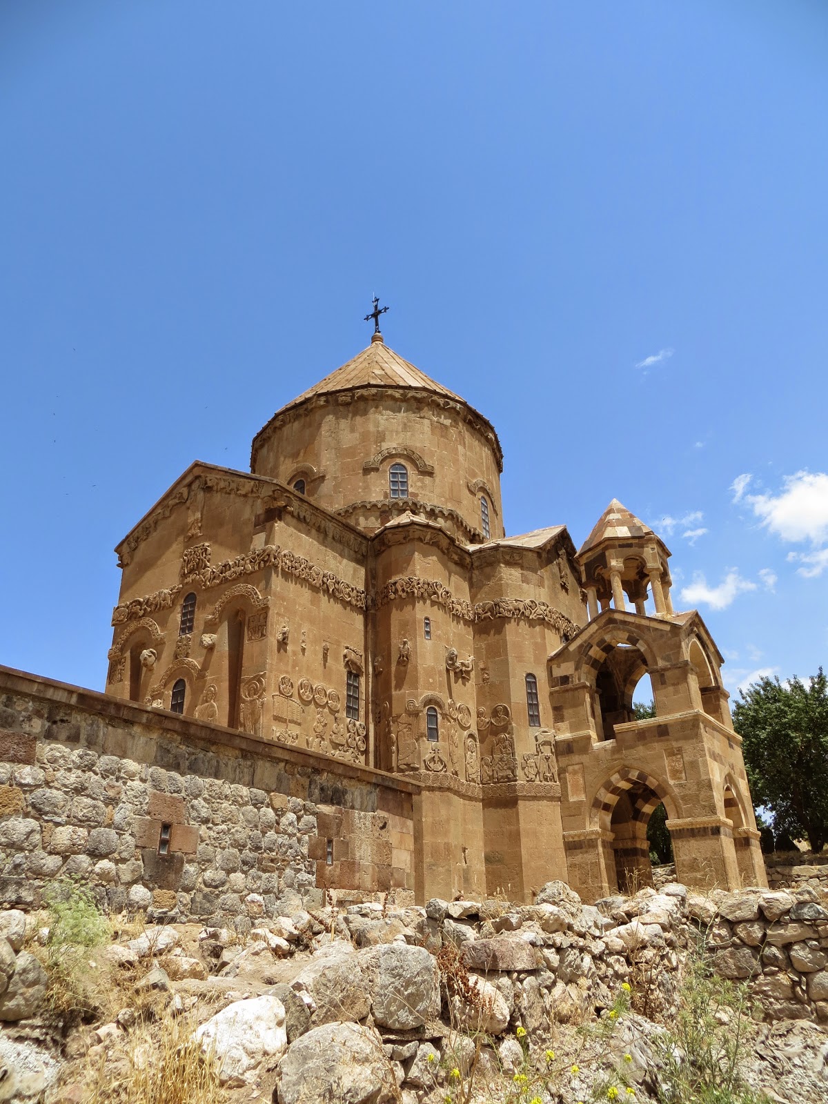
Narman was intended as the destination for the day, with it seen as being mid-way break between Van and Batumi. There are peribaclari rock formations which seemed like an interesting place to camp, not so frequently visited tourists as the more famous peribaclari in Goreme. Along the way to Narman, we were traveling through mostly agricultural Turkey, also not often frequented by tourists, hence the extra attraction from our fuel retailers. It's a bit strange I guess... 'So there was this Australian man, Mongolian woman and a German car pull up...'.

Along the way, we could see red dots here and there in the fields that we were passing. We had seen only but a few poppies since arriving in Turkey, naively dismissing them in the thought that we would be later passing fields completely full of them, which we hadn't. Stopping to make a closer inspection, what started out as a romantic gesture quickly failed as the red dot did not eventuate to be a poppy and resembled something more like a mutant weed variant. No more poppies were hence seen in Turkey. 

Shortly prior to our arrival to the Narman National Park, we stopped at a roadside watering point to fill our camping water supplies from a stream emanating from the white capped peaks above. The water was cold and clear, but with livestock grazing about and a bit of rubbish strewn about the fill point, it wasn't going to be drinking water untreated. Good for washing up.

Is it a poppy?
Nope... romance is dead.
Continuing the surprising trend in Turkey, the main road toward our destination was in excellent condition and we reached Narman quite early in the day. It was about 1pm, and stinking hot. Before setting out to have a look around the peribaclari, we had a picnic lunch not to dissimilar to the breakfast that we had in the shade of some trees nearby a small stream. 

After lunch, and a short nap in the shade, we set off to have a look around the peribacari. Driving into the National Park, the small track that we had entered on quickly petered out to nothing. Previously I thought that I had seen a track traversing the National Park on Google Maps, and had hoped that by following this we may have found a private gully to camp in, but it was not to be the case. We couldn't go very far into the rock formations by vehicle, and this, in combination with the high heat and humidity, lead to the suggestion that we continue driving toward the coastline. 

I can't say that I'll be able to visit this place again, and it is regrettable not to have ventured further into the National Park on foot, but I do think that we had successfully covered peribaclari rock formations from both on the ground and in the air at Goreme. 

Narman Peribaclari... not quite as impressive as Goreme. 
Interesting sculptures
As far as the road would take us
Good colour combination
Narman peribaclari

Not quite as impressive as Goreme
Leaving the Narman National Park at about 2.30pm, it was about 350 km to the Black Sea coast. Sounds easy... until hitting major (super major) roadworks for about 180 km of this! This included about an hour delay waiting for the roadwork crews to clear rubble from recent blasting. The Turkish seem to be the modern day Romans when it comes to road building; no obstacle is too great to be overcome, to allow a super smooth high speed motorway to be constructed. 

Prior to hitting the sections of bulk roadworks, we crossed over some relatively high mountains. The highest point was close to 2900m (a new record for the trip thus far, eclipsing the Stelvio Pass in Italy), but there was no monument at the top to know the name of the pass itself. We did cross the Kirecli Gecidi pass (2415m), though Gerle may need to watch the ensuing time-lapse video (from the dash mounted camera) to recollect this as she was fast asleep.

Not the highest pass of the day, but it was signposted.
To get to Sarpi, we needed to travel down a steep walled and narrow valley which the D010 road follows. Aside from one or two locations where the valley widened, for the most part the floor of the valley was only just wide enough to encompass the raging torrent beside us, and the road upon which we were travelling. The multitude of roadworks going on around us included tunnelling, bridge building, road repair and road construction at various levels for new road joining the bridges and tunnels under construction. 

Our route took us between old and new sections of road, confusing the GPS unit no end, but allowing us to see what the almost entirely new road would be like. Swift, would be the only way to describe it. Whereas the old road hugged the steep valley walls, the new road simply sliced and efficient straight-line path through the valley at a higher level. Whilst it would certainly make transit faster, hopefully the old road would remain for use by local and touristic traffic. 

This area would have been truly worthy of spending more time in. There were numerous historical sites worth looking at that we passed, good climbing and biking trails, and the villages that dotted the small valleys we encountered all seemed to have a charm that would have been worth visiting in slow travel mode. A good week or two could be spent travelling this area on bike, ideally starting high up away from the coast, to allow a casual descent back down to the sea.

One of the lakes on the valley floor where it widened

Stopping for a 'driver reviver' above one of the lakes that we passed. The passenger was more sleepy than the driver!

Chocolate + vanilla = Chocolate. Mixing of the valley streams.
By the time that we had passed through all of the roadwork, it was now starting to get dark. Low in the valley, the sun had disappeared from view long ago, but now darkness was descending. Keen to get down to the coastline, we pushed on, noticing how the temperature rose as we continued to descend. With limited opportunities to overtake slow moving traffic, we seemingly crawled down the final stages of the slope into the township of Kemalpasa.

Sarp was the border town with Georgia, only a few kilometres further along the coast, so we headed in this direction thinking that it would be possible to find somewhere to camp not too far off the road. The road hugged the coastline, and for the most part was wedged between steep mountain terrain or urban development to the south, and the Black Sea to the north. No where could be found to camp. Arriving in Sarp, we spent about 45 minutes searching fruitlessly (in the darkness) in the hills behind the township for a campsite, but everywhere flat and without forest was already populated. 

Admitting defeat, we checked into the Sarp Hotel. Overly priced for what it was, it was still quite nice to find ourselves in an air-conditioned room, with a private bathroom and comfy beds. After being denied the entry of some snacks from a small shop across the road (we had to, of course, use the hotel restaurant - which was bloody closed - for fear of food poisoning... WTF? Bad review on TripAdvisor coming up for the Sarp Hotel), we 'dined' on some room service beers before quickly falling asleep after showering, completely exhausted. 

Thursday, July 12, 2012

Day 32: Nemrut Dagi Krateri to Van

During the previous afternoon and evening, we had been aware of a very noisy rookery of birds nested on a coup of small islands in the Big Lake below. I don't know what kind of birds they were, except that they were super noisy. It almost sounded like laughter each time an individual bird broke into voice. Anyway,the noise died off after dark (mostly) but at first light the noisy buggers were at it again. Hence, we were again awake quite early, despite the rim of the caldera keeping the sun off the tent for quite a bit longer than when it actually became light.

Panoramic view of 'Bird Island'

Cautiously emerging from the tent, after a quick check around the car it was declared a 'bear free zone', and we set about restoring the camp. Nothing was missing, and no damage was done aside from the food box being overturned. With the Kelly Kettle boiled a few times, we took the time to enjoy some hot cups of coffee overlooking the lake as the rising sun changed the colours of the water and inner slopes of the caldera. After coffee, it was time for 'splash n dash' / 'rub-a-dub-dub' type wash, before washing up the dishes.

In the anonymity of the remote location we had chosen, we quickly stripped off and washed ourselves with a wet cloth each, before changing into some fresh clothes. I even managed to wash my hair, and Gerle whilst initially a little unsure of the idea of washing here soon got into it properly. No one came across us whilst we were washing, though we noticed a man was actually sitting surprisingly close to where we camped when we drove out from our camp location.

Panoramic view of the lake below our camping spot
Same view as the previous night, with sun from behind.
Breakfasted, washed and with the tent packed, we departed the campsite at about 8.30pm to make our way down the mountain and onward around the lake toward the city of Van. En route we planned to visit a small Armenian church on an island within the lake, the Van Castle and if time permitted some Armenian monasteries in the foothills behind the city of Van.

Leaving our campsite.
Initially after passing through Tatvan, the road to Van skirted the shore of Lake Van. A few kilometres further on, however, and the main road deviated inland. Seemingly every few kilometres for the entire 150 km drive from Tatvan to Van, there was roadworks. The amount of roadwork underway in Turkey that we had witnessed thus far was already astonishing, but this seemed to be the most intense area for new road development that we had seen. Turks build great roads. Another similarity with China.

Wanting to see more of the lake, which was in fact a beautiful blue colour almost like an ocean, I programmed the GPS to take us via secondary roads back toward the lake. This had us traverse up and over the separating mountain range, which with windy roads in combination with last night's wine almost got the better of Gerle. Stopping for a quick rest near a group of surprised beekeepers, we continued onward after Gerle had regained her composure.

Descending the other side of the range, we continued slowly through seemingly endless roadworks toward the town of Gevas, where we boarded a tour boat for the roughly 3 km trip into the lake to Akdamar Island. On the island was an Armenian church, the  Cathedral Church of the Holy Cross, whose initial construction period spanned 915-921 AD.

Looking out into Lake Van, it could be mistaken for a calm ocean.

The boat trip was brief, but the sunshine on the lake was beautiful with accompanying breeze from the movement of the boat. Aboard the boat was a father and his young daughter and son, of whom the daughter seemed to have a fascination with Gerle. For the 20 minute ride, a game of cat mouse ensued between the two, not wanting the other to notice that they were being watched.

Who is that strange girl wearing the colourful clothes? Where is she from?
Very shy, and tucked under dad's arm for safety.
Once we had arrived on the island, we took the time to wander through the Church which was quite stunning, evident of a carefully done and relatively recent refurbishment. The refurbishment itself was with quite a bit of controversy, part of the seemingly ongoing antagonism and mistreatment of Armenian heritage in Turkey. The refurbishment has turned the church into a museum only, and prayer services are not possible; there was a lengthy process to have the Catholic cross re-instated upon the church, which was eventually allowed in 2010. Being atheist, I don't really take sides in religious debates, but I think that something strange has happened here, perhaps a hangover related to the process of Turkification?

The Cathedral Church of the Holy Cross
Standing high above Lake Van on Akdamar Island
Inside The Cathedral Church of the Holy Cross

'Turkish Gerle' complete with scarf to supposedly cover the shoulders... the church was quite large inside.
Not bad condition for a 10th century construction!
Catholicism was a little surprising to find here 
After viewing the inside and outside of the church, we sat under the small trees of the island at a cafe to relax over some Turkish tea and snacks, amidst the other families visiting the island. It seemed quite popular, with probably around 100 or 150 people picnicking on the island. We were certainly the odd ones out, and for most of the time it seemed that at least 10 pairs of eyes were upon us at any one time. People were friendly though, with more than one family inviting us to join their picnic which we politely refused... picnicking would appear a little difficult when there is no way to communicate other than through mime.

Heading back to the mainland, the boat ride was faster and more comfortable than the original one, and we were again joined by the fascinated little girl and her family. The fun and games continued. Reaching the shore of the lake, we were across the road and into the car without stopping to browse the array of tourist merchandise and on our way to Van. 

The departure point back to the mainland
Headed for the mainland
The first planned stop in Van was the The Fortress of Van (also known as Van Citadel), which was built by the ancient kingdom of Urartu during the 9th to 7th centuries BC. The fortress overlooks the ruins of the ancient city of Tushpa (the Urartian capital during the 9th century BC), the modern city of Van to the east and Lake Van itself to the west.

After paying our entrance fee, we walked around the base of it looking for a path to the top. There appeared to be many unofficial tracks leading up the side of the slope toward the fortress, but nothing that seemed to be the correct way. Eventually we started up one of the rough tracks, and upon reaching the top realised that there was no formal entrance.

An intrigued Gerle braving the vicious geese
At the top of the Fortress, there wasn't much for looking at except for the view below and the ruins themselves. Both of these were impressive, but we had thought that the restored church may have been open to look inside.  We took our time exploring the top of the structure, the eastern side looking over the modern city of Van and the western side looking over Lake Van. The Fortress itself was perched on a steep bluff beneath the southern limit, with the walls of the fortress sometimes amazingly clinging to the steep rock upon which they were bedded down upon. 

The whole structure appears to be slowly undergoing refurbishment, which I guess is a little strange for the city of Van which is also undergoing major repair and refurbishment since the recent earthquake in late 2011. We watched the workmen for a while carefully rebuilding sections of the Fortresses internal walls and paths in what I assume was a traditional style involving raw stone and mud bricks. If the whole of the structure is refurbished (which will take some time, as it is indeed massive) the Fortress will look splendid once brought back to its former glory. 

Strangely, there were a number of buildings that somehow appeared to be buried on top of the hill upon which the Fortress was located. It was unclear whether these building were originally built in a subterranean manner, or the ruins of other buildings had eroded on top of them. At times we had to be a little careful where we walked, with large voids supported only be ancient brickwork literally centimetres below our feet. 

Walking up to the Fortress of Van.
It's a long way, to the top, if you want to...
Overlooking the modern city of Van
After finishing looking around the Fortress, we decided to forego venturing further inland away from the lake to visit the Armenian monasteries as it was now fairly late in the day. Finding a camp site was now a priority. Heading away from Van, we had hoped to simply follow the lake shore until we found something suitable, however with so many people seemingly displaced by the 2011 earthquake, this was harder than we thought it would be. 

Many people were living in temporary accommodation in the lakeside villages, in tents, shipping containers and other temporary constructions. It seemed that nearly every small village that we came to for about 50 km outside the city limits of Van had taken almost a population equal to its original inhabitants of those displaced by the earthquake. 

Stopping to get some bottled water, we were looked at quite curiously but in a friendly manner. The spirit of the people still seemed strong, but the shopkeeper was quite happy for the unexpected business. Continuing on, we drove for about an hour winding through the lakeside countryside, cutting across a small peninsula jutting into the lake until we again followed the lake shoreline again looking for a camping spot. 

For a while there were no beaches, just a sharp drop-off to the water below, which wasn't what we were looking for. We wanted a good beach access so that we could have a swim and a wash before dinner. Further around the shoreline we came across such a beach, that was a little too popular. Unfortunately the trend of 'where there are people, there will be rubbish' continued. Why can't people take their rubbish home with them!?!?

Continuing, we found a 4WD only track leading down to the beach, and following this found we could actually drive onto the beach itself. This was good, as driving along the beach we were able to get away from where others had been and found a (relatively) clean section of beach to park and camp. The only rubbish here seemed to be that washed up by the small waves, which though a considerable amount was 'cleaner' having been thoroughly washed whilst out in the water. 

Camping on the lake


Before the sun went down completely, we both went for a swim and had a chance to wash off before dinner. The water wasn't warm, but not too cold either, but the wind upon leaving the water certainly did feel cold. 

The lake water was also a little strange; I had known that Lake Van was an endorheic lake (having no outlet) and that it was saline, but it had a very different feel and taste to it. Not particularly salty, the taste was almost metallic, and the feeling was slippery as if we were bathing in a very light oil. It wasn't too bad, but we did rinse off under some bottled water after emerging.  I have since found that the lake water is strongly alkaline (pH 9.7–9.8) and rich in sodium carbonate, which may explain the taste and feeling.

We hadn't planned to cook anything, and thus had a simple dinner of tomatoe, tuna and cucumber sandwiches as we watched the sun set over the lake, the shoreline surrounding it light up and a thunderstorm roll by in the distance. It wasn't hot (we were still at RL1650) and with the firm breeze the tent was well ventilated. Sleep was good, the rhythm of the small waves lapping at the shore a peaceful background noise. 
Sunset over Lake Van
An evening swim, just before dark.

Wednesday, July 11, 2012

Day 31: Nemrut Dagi Milli Park to Nemrut Dagi Krateri

Waking early again as per habit of the past few mornings, and again with a long drive ahead, we were out of the tent prior to sunrise at about 5.15am. As we had camped not too far from the road, and not too far from the township, we figured it would be best if we packed up and moved on quickly also. It was quite a surprise, however, to have a man walking down the road in with suit and tie on, at about 5.30am as we had just finished packing up. 

The GPS was able to find a new route to take us in the direction we needed to go to make it to our planned destination for the night (Nemrut Krateri), avoiding the Google Map error of leading us along walking paths not accessible to vehicles. We decided to delay having breakfast until we reached the unavoidable ferry crossing of Ataturk Dam, figuring that by the lakeside would be a nice place to relax with breakfast whilst waiting for the scheduled service departure. 

Setting off for the first two hours we covered only about 60 km, as we were busily winding up and down the mountainsides in a seemingly endless maze of hairpins atop steep unguarded slopes. It made yesterdays detour road look like a learner driver training ground. Having not expected it to take so long to reach Ataturk Dam, we stopped by the roadside where we had a good view over the valley below for a quick breakfast of bread, tomato and tinned tuna. 

Almost Stelvio-esque

The bonnet served as the breakfast table


With strength regained from breakfast, we continued driving and the twisting and turning roads soon petered out as we descended into broad valleys on approach to Ataturk Dam. Before we reached the dam, we did pass by two noticeable monuments; the Old Khata (somewhat confusingly called the New Fortress) and the Cendere Bridge.

The Old Khata has been proven as the palace of the Commagene kingdom, and apparently inside this castle there are water tanks, a bazaar marketplace, a mosque and a prison. Having taken much longer than expected to get this far, we didn't stop to investigate further - much to the disappointment of a young boy both surprised and eager for tourist business at 8am in the morning. 

The Cendere Bridge (also callused the Severan or Chabinas Bridge), was built by four Commagenean cities in honour of the Roman Emperor Lucius Septimius Severus. The bridge is constructed from 92 stones, each weighing about 10 tonnes. The form of the bridge is as a single arch spanning between two rocks at the narrowest point of the Chabinas Creek. 

At 120m long, and with the arch spanning over 34m, it is the second largest known extant arch bridge constructed by the Romans. It is 7m wide, and is still being used for modern day traffic for vehicles up to a mass of 5 tonnes. Again, having spent longer getting to this point than expected, we did not stop, but viewed the bridge as we drove past on the bridge constructed in modern times for the bulk of the traffic passing through.


Old Khata (New Fortress), palace of the Cammageneans
Cendere Bridge, the second longest Roman extant arch bridge
Contemplating life nearby the Cendere Bridge

Getting closer to the dam, we rejoined a major road that would now take us most of the way toward Nemrut Krateri and eventually the city of Van the following day. Though the road was of good construction, it appeared that there was not much traffic... until we were almost at where the ferry departed from and we passed a rash of vehicles. Arriving at the ferry departure point, it was clear that we had missed the ferry service by about 5 minutes, with the boat slowly departing around a corner in the distance. 

Not to worry... though we had already had some food for breakfast, we were happy to sit down to some hot tea that was eagerly administered to us by a boy aged about 12. He was keen to practice some English, and even keener to make a sale. So, for the next hour we sat drinking tea in the shade of some trees by the lake at this makeshift cafe. With the ferry almost due to return, we had a quick look about at the waters edge where there were plenty of bait sized fish to see, but not much else, before returning to the car in order to board the ferry. 

Without signs or instruction, we acted like sheep and essentially followed the other vehicles onto the ferry. It was a bit of a worry at the start, as in typical local fashion the queue meant almost nothing, and we were a bit worried about missing our place on the relatively small vessel and having to wait for another hour as vehicles that had seemingly arrived 5 minutes previously boarded ahead of us. Not to worry, there was actually plenty of room in the end, and we boarded without issue. It was only as we were unloading at the other end that we were asked to pay for the ferry... a mere 10 Lira.

The ferry wasn't much of a boat, more of a pontoon with vehicle access and a motor, but it did the job. The days of its existence seem limited however, with roadwork and bridge construction clearly visible during the journey that would indicate that  road will bypass the need for the ferry over the Ataturk Dam in the near future.

Our ferry arrives to collect us

Roadworks in progress that will soon bypass the need for the ferry service

First stop: truck delivery to the roadwork site (truck reversing off the ferry)
Remaining vehicles aboard the ferry
Gerle was the only woman on deck
Vehicles waiting to board where we disembarked

For the next few hours we continued westward along an excellent highway at good speed. Initially climbing from the valley that contained the section of Ataturk Dam that we crossed, we were quickly up to high elevation again where the temperature dropped. The rolling countryside at times looked a lot like rural areas of Mongolia, except that in most places the land was being cultivated. 

During this drive I was stopped multiple times at speed traps by the Turkish highway police; I am still unsure where or not I was doing anything wrong. The police were neither friendly nor unfriendly, all wanted to see the my license and were not interested in our passports, but as none spoke English we were sent on our way. I am pretty sure we were well above the speed limit, but couldn't be sure as the speed limits were pretty hard to decipher at times in Turkey (based on deciphering just what type of road one was on).

We stopped at a nondescript village to get fuel, but for the first time in Turkey (and the whole trip), my VISA card wasn't going to work at the cash register. None of the plastic in my wallet would work, despite multiple tries. Without the cash to pay for the fuel, amidst about 20 minutes of illogical attempts at problem solving by the staff, I announced I would leave the car parked here and go and find an ATM to withdraw cash... this didn't seem to register too well with the staff who didn't want to let me go. 

Finally, I was able to explain that I had money, but that it was their system not working. With the car (and Gerle) left as security, I managed to withdraw some cash and return to pay for the fuel. Somehow, after that, I received some Lira and other items (Coke, water, etc.) in change, as well as a manual car wash for only 1 Lira. It was a weird transaction!


After another hour of so, we stopped in another nondescript village to get some lunch. This place was unused to foreigners, and we seemed to be a major attraction (particularly for the local boys and men who were very interested in 'Yapponaise' Gerle). Lunch was good; shashliks, salad and bread... though we were both a bit concerned with the water and general cleanliness provided. Thankfully, no ill affects were felt beyond the lack of normality we were both already experiencing since leaving Istanbul.

Approaching closer to Van, we were soon aware of the military presence here. Perhaps this was as a result of the current (at the time and continuing now) activity in Syria? Anyway, we needed to stop a few times, show our passports and discuss our intentions, but at no time was it a problem for us and we were waved through the checkpoints. 

Almost about to enter the town of Tatvan, we turned off the main road north on a nondescript track without signage that according to Google was the way to the Nemrut Krateri. After an initial mix-up that was quickly sorted out by some excited young boys who were all too glad to receive some small presents for their efforts chasing us through a small village, we found some signage to follow into the crater itself. 

Mt. Nemrut is an extinct (I think) volcano rising from the southwestern shore of Lake Van. The peak of the caldera rim is at about 3050m above sea level, and the lake within at approximately 2250m above sea level. There are actually two lakes; 'Big Lake' and 'Warm Lake', which can reach temperatures of about 60 degrees Celsius indicating continued volcanic activity beneath. The last known eruption occurred in AD 1597. 

We were able to drive into the crater (there are roads going through the crater to destination on the other side of the caldera from Tatvan), and our path crested at about 2600m above sea level. Descending into the caldera, it as surprising to see that there was land under cultivation, livestock grazing and even forests within. The caldera is an elliptical shape of approximate dimensions 7 by 8 kilometres, so did feel like we were descending into a rather large hole.

Bypassing a 'camp ground' that looked more like a 'refugee shelter', we passed by the 'Warm Lake' to the shore of the 'Big Lake'. Here it was only too obvious that it was a popular place for camping, with rubbish strewn everywhere. Not too happy with this, we decided to backtrack and see if we could find somewhere to camp in the grassland atop one of the bluffs overlooking the lake. 

Heading off road, we followed a barely there track through the scrub before coming to the conclusion that it was taking us nowhere good. After a bit of mucking about and almost getting bogged, low range 4WD enabled us to reverse back up the slope which we had travelled down. There was no where to turn around without risking getting seriously stuck in the mud. I guess I had imagined that we would have been walking distance to the lake, but we settled on a great spot that although was quite distant from the lake provided us with panoramic views of the lake and the crater rim above.

Over the 'Big Lake'
The view from the campsite
Good photo, shame about the model.

It was relatively early, about 6pm, when we arrived. Thus, with time on our hands we relaxed and enjoyed the last of the sun which wasn't too hot at this elevation. We had a few beers in the fridge, which went down well at the end of the day, before we opened a bottle (actually two bottles eventually) of the wine that we had purchased in Goreme. This was also quite nice, the Rosé in particular. 

Our campsite
Gerle, by now an expert camper, taking it all in her stride.
Toyota... can get you anywhere.

As it darkened, the temperature dropped considerably. Gerle rugged up and I put on jeans and a fleece, and tending to the barbecue was a pleasure. We had picked up some chicken drumsticks and lamb chops amongst other things at a small supermarket earlier in the day, and with the other remaining food items that we had with us from previous nights camping we were able to cook-up something of a feast with the luxury of time that we had both remaining today and with only short distance to travel the following day.


The Cappadocian Rosé went down well (yes, Gerle is wrapped in a towel for warmth)
Mmm.. lamb chops, chicken drumsticks and mushrooms on the barbecue.


We ate dinner as we cooked it, with the small grill doing well to cater to two by now tipsy and hungry carnivores. We had a  great night as the moon rose above the lake, providing ample lighting without need for torches. Carelessly, we discarded the food scraps in an 'over the shoulder' fashion, not thinking that we would have an issue for disposing of biodegradable waste in such fashion... 

With the barbecue burnt out, all our food eaten and no beer or wine remaining, after a quick trip to the nature toilet we were up and into the tent. The temperature was not cold once away from the gentle yet firm breeze, and we were soon cozied up under the blanket and asleep very quickly.

A few hours later, at about 1.30am, I awoke to the sound of something rummaging through our camping equipment, which we for the first time since Austria figured was safe to leave unpacked and out of the car. It was definitely a rummaging sound, not someone trying to be careful about avoiding noise, so I figured it must be some kind of animal. Maybe a cow, sheep or goat looking for the uncooked vegetables in the food box?

Poking my head outside the tent door, and then turning on the torch, I was a bit unsure of what I could see at first. Was it a dog? Crikey... it was a big dog. Despite being six feet off the ground and inside the tent, there was a little surge of a adrenalin within.

Wait a minute... that's not a dog. It is too squat, with no tail and short nose. Holy mackerel... that is a bear! A god damn bear!!!! Now the adrenalin was pumping. Not wanting to panic Gerle, I didn't tell her anything yet. It seemed like a pretty small bear... but I wasn't about to get out of the tent and shoo it off yet. Kangaroos, OK, bears... not a bloody chance. 

Almost immediately my mind focused on the size of the bear. I'm no expert, but I figured that it wasn't yet the size a fully grown black bear should be. Did that mean that Mama bear was somewhere nearby as well? Now I sure as shit wasn't getting out of the tent until the morning when I could see all around the car and tent. True to the discussion that bears are actually quite timid, simply shining the torch in the eyes of the bear had it moving on out of sight pretty quickly. I could hear it in the distance munching on the discard lamp chop bones, so I wasn't going to pack up camp now. 

In the morning, after a cautious scan about the car before fully descending the ladder, inspection of the campsite revealed that nothing was missing and all that had happened was that the bear had overturned the Esky looking for food and found nothing appetising. Another two good lessons learnt; (i) pack up camp before going to the tent, and (ii) dispose of foodstuffs carefully. I wasn't expecting an encounter with a bear in Turkey, but knew of their existence in countries like Georgia, Tajikistan, Kyrgyzstan and Russia. There were likely some other scavengers that we would come across best not to invite into our camp also.

If only I had the presence of mind to have taken a photo before the bear sauntered off, the chance encounter would have bee perfect... trust me, it's a true story!